
Abstract
The Zayandeh Rud is the most important river in Esfahan Province. It has long been the source of water for irrigated agriculture as well as for the urban water supply for Esfahan city. In recent decades water has become increasingly short and the basin has shown signs of salinization of agricultural land and increased pollution in the lower reaches of the river.
Although increased supplies have been made through transbasin diversion into the upper reaches of the Zayandeh Rud, there are significant threats to irrigated agriculture arising from more intense competition for water from the growing urban and industrial sectors, continued salinization in lower parts of the basin, and deteriorating water quality along the river.
In 1998 a collaborative project commenced between the Iranian Agricultural Engineering Research Institute (IAERI), the Esfahan Agricultural Research Center (EARC) and the International Water Management Institute (IWMI) to explore ways in which integrated management of water resources at basin, irrigation system and farm can help to promote and sustain agricultural development into the future. This publication outlines the current water management issues in the basin and describes the approaches being adopted under the Iran-IWMI collaboration.
Introduction
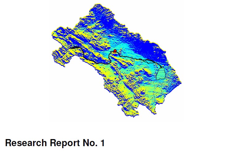
The Zayandeh Rud is the most important river in Esfahan Province in central Iran. Largely fed by snowmelt from the Zagros mountains it flows down into the basin which contains the city of Esfahan (Figure 1). It is a closed basin with no outflow to the sea: the river terminates in the Gavkhuni Swamp which is a natural salt pan.

Figure 1: Location of Zayandeh Rud basin, Iran
The river has provided the basis for centuries of important economic activity, including the growth and establishment of Esfahan itself as the former capital city of Persia. The region has been able to support a long tradition of irrigated agriculture as well meet the domestic needs for a substantial population. More recently large increases in industrial activity have increased demand for water, and the Zayandeh Rud is showing typical signs of a river basin under threat.
The continued growth of urban population over several centuries and the recent rapid increases for industrial uses have led to a competition for water with the agricultural sector, and there has normally been insufficient water to irrigate the total irrigable area. This has resulted in development of saline soils in lower portions of the basin, significant gaps between actual and potential yields, and a reduction in quality of return flows into the Zayandeh Rud. In addition to increased salinity in the river downstream of the major irrigated areas, there is more urban and industrial effluent being returned into the river, so that downstream water is badly polluted. Although some of the gross shortfalls in water are met through trans-basin diversions from other catchments in the Zagros Mountains, these will not automatically reverse the trends towards less water, and water of lesser quality, for both agricultural and non-agricultural uses.
The Iran-IWMI Collaborative Research project established in 1998 aims at addressing the role of water management for sustaining agricultural productivity. Through an integrated program that looks at basin level water management, management of irrigation system and farm level water management practices, the project aims to find solutions for three main elements of water management problems: alleviating soil salinity, minimizing the negative impacts of return flows to the Zayandeh Rud, and attempting to reduce the gap between actual and potential yields. The project uses modeling and simulation techniques to assess current conditions and the impact of possible future changes on water conditions at each of the three spatial levels of study: basin, irrigation system and farm.
The project is fully funded by the Government of the Islamic Republic of Iran through the Ministry of Agriculture, the Iranian Agricultural Engineering Research Institute, and Department of Agricultural Engineering of the Esfahan Agricultural Research Center.
The Zayandeh Rud basin
Topography and geomorphology
The Zayandeh Rud basin covers 41,500 km2, with the main Zayandeh Rud running for some 350 km roughly west-east from the Zagros Mountains to the Gavkhuni Swamp. The basin is closed, with no outlet to the sea (Figure 2). The Zagros mountains, which form the natural divide between the inland basins of Iran and the Persian Gulf, are the natural watershed for much of Iran. Steep and rugged, and rising to 4548 m, they are of little importance agriculturally and have not formed the basis for large settlements. Most valleys have perennial streams with good water quality.
The majority of the basin is a typical arid and semi-arid desert. Abrupt hills and mountains rise out of gently sloped alluvial fans, which are dissected, by non-perennial torrents. Soils are stony and normally only support a sparse scrub vegetation suitable for grazing. However, as the rivers and streams reach the flatter plains of the basin, there are opportunities for agricultural development through irrigation.
The most fertile parts of the basin are the alluvial deposits flanking the Zayandeh Rud where slopes are gentle and soils have good soil moisture holding capacities. These areas have groundwater close to the surface, which is recharged by the Zayandeh Rud.
There are only limited possibilities for large-scale irrigation on the alluvial fans, which are mostly freely drained and have poor soil moisture holding capacity. In many areas there is groundwater at depth that can be accessed either through traditional “qanats” (horizontal tunnels dug into alluvial fans to reach groundwater at the base of hills) or more recently, through deep bore holes.
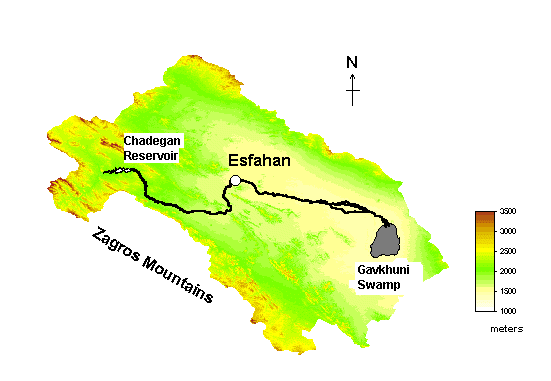
Figure 2: The Zayandeh Rud basin