
Abstract
This paper provides an overview of the hydrology and water use in the Zayandeh Rud basin based on the data available over the 11-year period 1988-1998. The inflows into Chadegan reservoir, the releases from the reservoir, and the extractions along the river for irrigation and other purposes are considered, and a rapid water balance of the basin is performed.
Inflows to the Chadegan reservoir, which serves to collect and regulate the runoff from the upper catchment of the basin to better meet the downstream water requirements for irrigation, urban and industrial uses, follow a regular pattern with moderate variability. But the limited year-to-year carryover storage in the reservoir makes the basin vulnerable to prolonged periods of drought.
Water releases from the Chadegan reservoir also show a predictable pattern, with the only deviations occurring during flood events. There is a high reliability of meeting the water requirements during periods of peak demand. But releases during the winter months, at the end of the irrigation season, are lower and more variable. This results in low discharges in the Zayandeh Rud and reduced water quality, especially in the lower reaches of the river.
A simple water-balance approach was used to estimate the proportion of return flows in the basin. An average annual value of 30% was obtained, with the magnitude of return flows being particularly important in the lower reaches of the basin. But more investigation, especially including groundwater and water quality aspects, needs to be carried out before a definitive value can be advanced.
Given the limited supply of fresh water in the Zayandeh Rud basin, further water resources development and water management improvements can only be envisaged if there is scope for real water savings in the basin. This can be assessed if a basin-wide approach, leading to a good understanding of water use (and reuse) at the farm, system and basin levels, is adopted.
Introduction
The Zayandeh Rud is a vitally important river for agricultural development, domestic water supply, and overall economic activity of the Esfahan Province in central Iran. However, population growth and greater industrial activity have increased the demand and competition for water resources in its basin. The agricultural sector has been particularly affected. Water shortages not only make it difficult to irrigate the full extent of irrigable land, but also lead to the salinization of soils in the lower portions of the Zayandeh Rud basin and a reduction in the quality of return flows into the river. The lower reaches of the river downstream of Esfahan are further polluted by ever-increasing quantities of urban and industrial effluent being returned into the river.
The IAERI-EARC-IWMI Collaborative Research project, established in 1998, addresses the question of how integrated approaches to irrigation and water management can contribute to sustaining agricultural productivity in the Zayandeh Rud basin, taking into account the multiple uses of water in the basin.
Water use, and especially the scope for further water resources development, cannot be ascertained by analyzing water utilization only at the farm or system level. Proper accounting of water availability and water use at the farm, system and basin levels is required, particularly in the context of limited supplies of fresh water and multiple uses of the available resource. Return flows from seepage, percolation and surface runoff traditionally considered as “losses” at farm and system level must all be taken into account. Molden (1997) proposed a water accounting framework where water balance components are classified into water-use categories that reflect the consequences of human interventions in the hydrological cycle.
It is also worth noting that a number of authors (Seckler 1996; Keller et al. 1996; Perry 1996; 1999) have raised questions regarding the traditional concept of irrigation efficiency, which typically relates the volume of water beneficially used (i.e., crop evaporation) to the amount of water diverted to a use. First, increases in efficiency at a local level do not necessarily lead to water savings at a basin level. Second, increases in efficiency defined in this manner are not necessarily better. For example, higher evaporation with the same diversion may lead to environmental degradation, or water may be evaporated by a less beneficial use. To get a better indication of how well water is being used and of the scope for additional beneficial use, it is perhaps preferable to compare the amount of water depleted by various uses deemed to be beneficial, to the amount of water available for use in that basin — the concept of basin efficiency proposed by Molden and Sakthivadivel (1999).
This paper provides an overview of the hydrology of the Zayendeh Rud basin, from the point of view of the inflows into Chadegan reservoir, the releases from the reservoir, and the regulation and use of flows along the river for irrigation and other purposes. A rough water balance of the basin highlights the challenges related to managing and improving the productivity of water in a closed basin, especially in regard to the need to correctly assess the degree of return flows when seeking water management improvements.
The Zayandeh Rud Basin
Physical Description
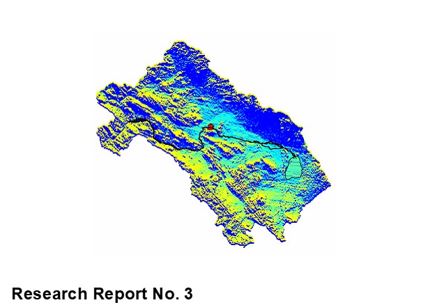
The Zayandeh Rud basin lies in central Iran (Figure 1). It is a completely closed basin having no outlet to the sea. The river is about 350 km long and runs in a roughly west-east direction, originating in the Zagros Mountains, west of the city of Esfahan, and terminating in the Gavkhuni Swamp to the east of the city. The Zayandeh Rud provides irrigation, domestic and industrial water to Esfahan Province, which is one of the most important economic areas of Iran.
The area of the Zayandeh Rud basin is some 41,500 km2. However, only the area upstream of the Chadegan reservoir makes any significant contribution to the streamflow. Below the reservoir there are virtually no inflows into the river, and they are so infrequent that it would be impossible to use them in any planned manner. The total water supply in the basin is augmented by the diversion of water from the Kuhrang River in Chaharmahal-va-Bakhtiari province into the upper reaches of the Zayandeh Rud. Two diversion tunnels in operation since 1986 can deliver 540 million cubic meters of water a year while a third tunnel, expected to be ready in a few years, will deliver a further 250 million cubic meters of water annually.

Figure 1: Location of the Zayandeh Rud basin
The Chadegan reservoir provides storage of winter and spring runoff and its releases are used to regulate flows in the river. There is a series of diversion weirs along the river, and numerous locations where urban areas and industry can extract water.
The upper catchment covers about 4,000 km2 or less than 10% of the total catchment. The upper catchment is mountainous, with peaks rising to as much as 3,500 meters, and there is little utilization of water upstream of the reservoir. There are natural forests in the upper catchment although most of the higher land is barren.
The central and lower portions of the valley are natural arid and sub-arid areas. Steep mountain ranges rise up out of the valley floor, but the majority of the landscape consists of gently sloping alluvial fans with dry streambeds where there are occasional flash floods in rare storms. The natural vegetation here is sparse thorn bush and drought resistant grasses, and there is a high percentage of bare rock and soil.
The basin terminates in the Gavkhuni Swamp which is a natural salt pan. Much of the area surrounding the swamp is sandy and there are extensive dune areas just east of the swamp. Water entering the swamp area is extremely saline, with EC values as high as 30 dS m-1 during periods of low flow (Salemi et al., 2000).